From space to safety
Météo-France’s Sylvain Le Moal discusses preparing users to harness Meteosat Third Generation's advanced capabilities to support everything from storm forecasts to more timely wildfire tracking
As the Meteosat Third Generation Imager 2 (MTG-I2) satellite undergoes final preparations for its launch later this year, the work of readying Europe's meteorological community for its data is well underway.
Sylvain Le Moal leads Météo-France's MTG user project, coordinating efforts to ensure that when MTG satellites reach orbit, forecasters and researchers are best positioned to extract maximum value from the data provided by their advanced instruments.
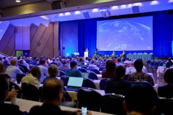
Photo: Courtesy of Sylvain Le Moal
Photo: Courtesy of Sylvain Le Moal
Since December 2024, MTG-I2's twin imager satellite, Meteosat-12, has been delivering a steady flow of timely images from its Flexible Combined Imager (FCI) and Lightning Imager (LI). Le Moal's attention is on both preparations for the new satellite, which will deliver MTG's Rapid Scanning Service every 2.5 minutes, and the benefits already emerging from the MTG programme, which supports everything from better storm forecasts to more timely wildfire tracking.
Protecting lives and livelihoods
“The role of meteorologists and climatologists is to provide people with the best information, whether they are members of the public, policy makers or emergency responders,” says Le Moal, who is Deputy Director of the Satellite Meteorology Centre (CMS) – Météo-France’s satellite operations hub.
“It might be informing this week’s forecast, predicting when a sudden storm is coming, or identifying when the risk of wildfires is high. Satellite data underpin services that safeguard people and property, raise awareness of the causes and consequences of climate change, and guide efforts to reduce impacts.”
Credit: Météo-France
Credit: Météo-France
Based in Lannion, Brittany, Le Moal oversees a team responsible for acquiring satellite imagery, processing it into real-time products, and distributing them to forecasters, civil protection authorities and other users. On average, the centre handles around 700 satellite data products and some 20,000 data files a day. With such close connections to both data providers and users, Le Moal is well placed to see how the new data are being put into action.
“Forecasters in France are using images from the FCI and LI every day,” he says. “Meteosat-12 data are already proving especially valuable for tracking convective storms, wildfires, dust events and volcanic ash. Work is also under way to integrate these observations into numerical weather prediction models, and as a result we are confident they will substantially improve life-saving forecasts.”
Reaching this stage was not without difficulty. EUMETSAT’s engineers had to contend with setbacks after the launch of Meteosat-12, most notably when its FCI suffered months of interrupted service when hardware problems prevented proper calibration. An ingenious solution was eventually devised, and Le Moal says that the start of the satellite’s full operations underlines just how critical the instrument has already become.
“Until the first data arrive from a satellite mission, there is always a concern that something might go wrong with the rocket launch, the satellite’s orbital positioning, or the commissioning of the instruments,” he says. “Yet despite these challenges, the images we are now receiving from Meteosat-12 are truly outstanding.
MTG products can clearly show the difference in cloud temperatures: from red for colder parts to blue for warmer parts. Image: EUMETSAT
MTG products can clearly show the difference in cloud temperatures: from red for colder parts to blue for warmer parts. Image: EUMETSAT
“I had never imagined we would be able to deliver so many critical MTG datasets to users so soon after operations began, with nearly 50 products now available. Some are continuations from Meteosat Second Generation, enhanced by MTG’s higher resolution and more frequent delivery. Others are entirely new, including advanced fire detection, cloud classification, ash monitoring and lightning products.
“The breadth of what is available shows what can be achieved by the European meteorological community working together. By combining knowledge and expertise we avoid duplicating work, save time and can make the most of these powerful new datasets.”
Synergies in storm prediction
Storms and lightning over eastern Europe, as seen from Meteosat-12. Image: EUMETSAT
Storms and lightning over eastern Europe, as seen from Meteosat-12. Image: EUMETSAT
Much of this potential comes not only from individual instruments, but from combining their data.
“One of the clearest advances from MTG has been in severe storm monitoring,” says Le Moal. “We can combine images from the FCI and the LI, and that makes it easier to track the rapid development of storms. High-resolution images let forecasters see more detail in the structure of the cloud tops, while lightning flash-rate data give essential information about storm evolution. Together they can reveal clues about the storm’s strength and whether conditions are favourable for hail or even tornadoes.
Artistic impression of the MTG-S1 Infrared Sounder instrument, which will be able to provide information on horizontally, vertically, and temporally resolved water vapour and temperature structures of the atmosphere. Video: EUMETSAT
Artistic impression of the MTG-S1 Infrared Sounder instrument, which will be able to provide information on horizontally, vertically, and temporally resolved water vapour and temperature structures of the atmosphere. Video: EUMETSAT
“Already we see airlines using MTG products to improve flight safety and comfort. However, in many respects this is only the beginning. Another leap will come when MTG imager data are combined with observations from the newly launched Meteosat Third Generation Sounder 1 (MTG-S1) satellite, which is being prepared for operations. Once MTG-S1 starts delivering atmospheric temperature and humidity profiles, we will be able to follow storms from their very first signs right through their life cycle. That will lead to a revolution in nowcasting severe weather.”
Wildfire monitoring provides another example of MTG’s value, Le Moal says. In August 2025, blazes in the Aude region became France’s largest in more than 70 years, burning around 16,000 hectares. Meteosat-12 tracked smoke plumes spreading across the Mediterranean, providing continuous, high-frequency imagery that was available to forecasters and emergency services in near-real time.
Image: European Union, Copernicus Sentinel-2 imagery
Image: European Union, Copernicus Sentinel-2 imagery
“The FCI includes highly sensitive near-infrared bands that allows us to detect wildfires,” he says. “One pixel over France is about 150 hectares, but the high sensitivity of the instrument means we can sometimes detect much smaller outbreaks. For example, in August in the south of France we picked up the start of a fire that had burned only two hectares. Now we can imagine a pop-up on an emergency responder’s workstation saying: have a look, there may be a fire here – and perhaps put it out before it becomes uncontrollable. It is exciting to think about the possibilities.”
Image: EUMETSAT
Image: EUMETSAT
Getting the message across
“We work very closely with the media, and we are in discussion with television channels to improve weather bulletins. With MTG’s better resolution we now have superb satellite animations with flashes from the LI overlaid. It makes it easier for audiences to grasp risks from storms, heatwaves or poor air quality and act on the warnings.”
For Le Moal, these milestones also build on what has come before. The CMS was the first European site ever to process a weather satellite image, received from NASA’s Tiros-8 on Christmas Eve, 1963. Comparing those early images with today’s rich datasets from geostationary and polar-orbiting satellites such as Meteosat and Metop, he says, shows just how far the science has come – and how many new opportunities and challenges it brings.
The EUMETSAT Conference brings the European and global meteorological community together, photo from the 2023 event, which took place in Malmö, Sweden. Photo: EUMETSAT/Jonas Persson
The EUMETSAT Conference brings the European and global meteorological community together, photo from the 2023 event, which took place in Malmö, Sweden. Photo: EUMETSAT/Jonas Persson
“For young researchers today, I always say: you cannot be a specialist only in satellite data or only in radar. The best approach is to combine all the data available, from all sensors worldwide. Even in five or ten years, I think we will be surprised by what can be done with the new data from MTG and Metop Second Generation.
“This is what makes EUMETSAT's next-generation programmes so valuable. They bring the whole community together to share ideas, compare experiences and build collaborations. It is through this kind of exchange that we can fully realise the potential of the new satellites and prepare for what comes next.”